One of the great things about the growth in digitisation of library and museum collections means that the collections can be browsed without travel and material that even if you made that journey may not be available to the general public.
As St Patricks Day arrives (17 March) I thought it might be a good time to look at the mapping of Ireland what could be found online . The earlier maps were drawn with little real geographical knowledge and were therefore prone to bias and perhaps exaggeration of a locations size to match its perceived importance.
The earliest map of the British Isles is the Mappa Munde dated 1025-1050, available in the British Library collection.
Ireland - an undistinguished blob- but mapped nonetheless.
Also in the British Library collection is this map on vellum from the 1530s. This has some rudimentary coastal detail. What it lacks in detail it makes up for in character with some nice illustration.

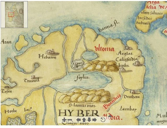
This map in the British Library collection dated in the mid 1500s has more detail with lakes, rivers, mountains and Islands.
In the Library of Congress collection are some later maps showing the growing accuracy of mapping. This map dates from 1598 and also marks St Patricks purgatory in Lough Derg.
And this on this map Loug Derg and St Patricks purgatory are marked together.
St Patricks Purgatory was and remains an important site of pilgrimage.
This is how it appears on google maps today.
You have to look hard to find it!
Happy St Patricks Day !


